


 LEO Satellite Communications Empower Maritime Aids to Navigation, Enhancing Navigational Safety and Support Capabilities
The Challenge
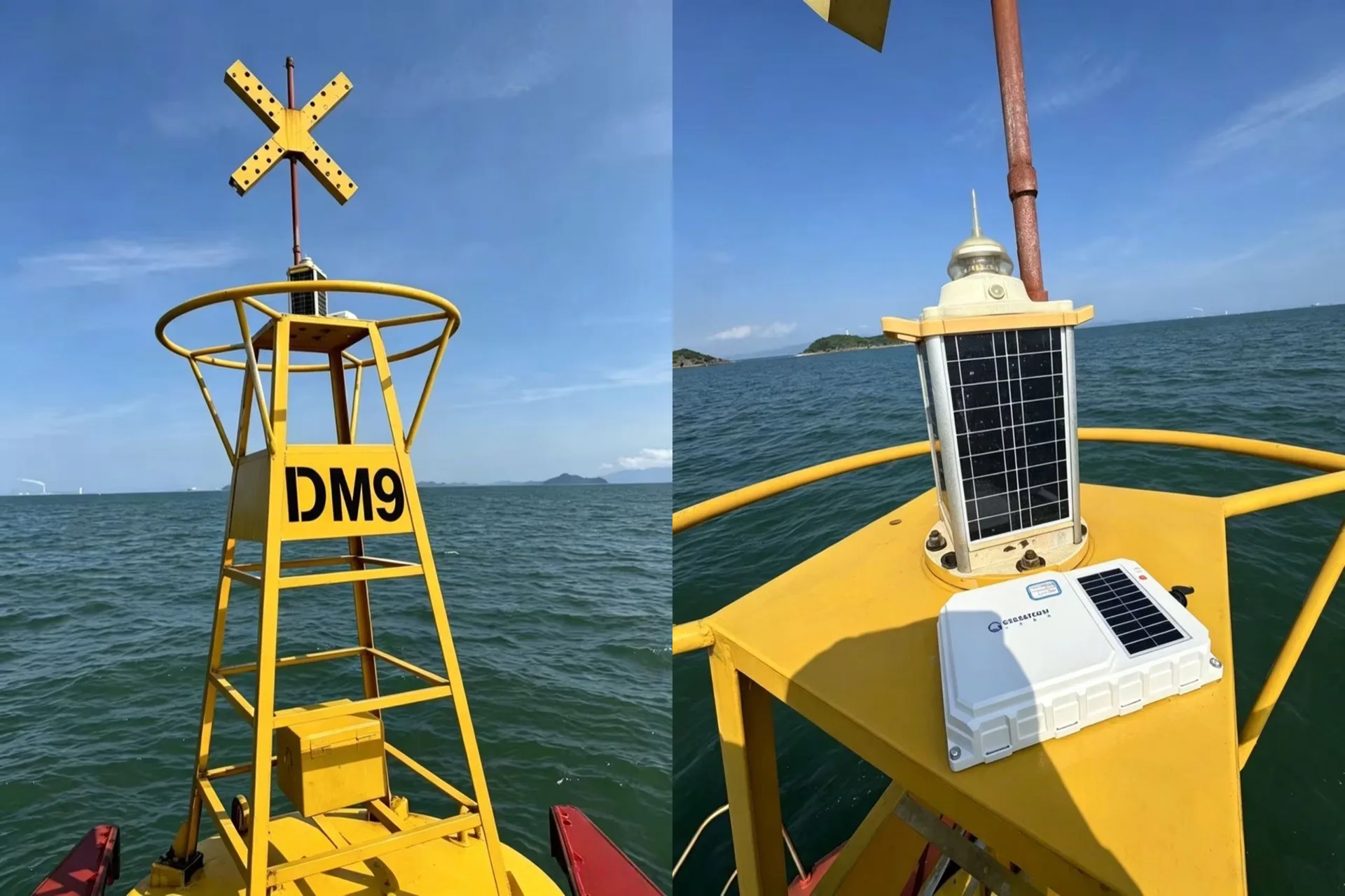
Shore-based communication networks in the eastern Guangdong sea area face challenges including incomplete coverage, frequent signal interference, and significant communication gaps in offshore areas. These limitations make it difficult to continuously transmit navigation buoy positioning information and equipment operational data. In particular, ensuring stable data transmission from navigation buoys under challenging sea conditions is essential to improving intelligent management and control, as well as operational and maintenance efficiency in maritime safety support.
The Solution
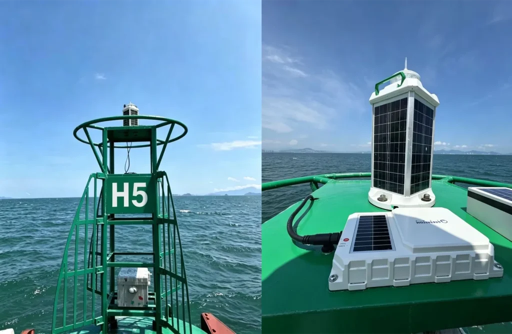
The Shantou Aids to Navigation Administration, in collaboration with Zhejiang Geespace Technology Co., Ltd., conducted dedicated technical research and application studies on LEO satellite communications for maritime aids to navigation.
Two lighted buoys in the petrochemical zone of Daya Bay, Huizhou, were selected for the pilot project. Both buoys had experienced frequent signal interference and delays in data transmission. LEO satellite IoT terminals were installed on the buoys to establish a dual-link redundant communication architecture combining 4G and satellite communications.
The pilot project leveraged the key advantages of LEO satellite communications, including wide-area coverage, low latency, high reliability, strong resistance to interference, and efficient bidirectional data transmission. This effectively filled communication gaps beyond the reach of shore-based networks and provided technical support for all-weather monitoring of navigation buoy status and reliable data transmission.
The Impact
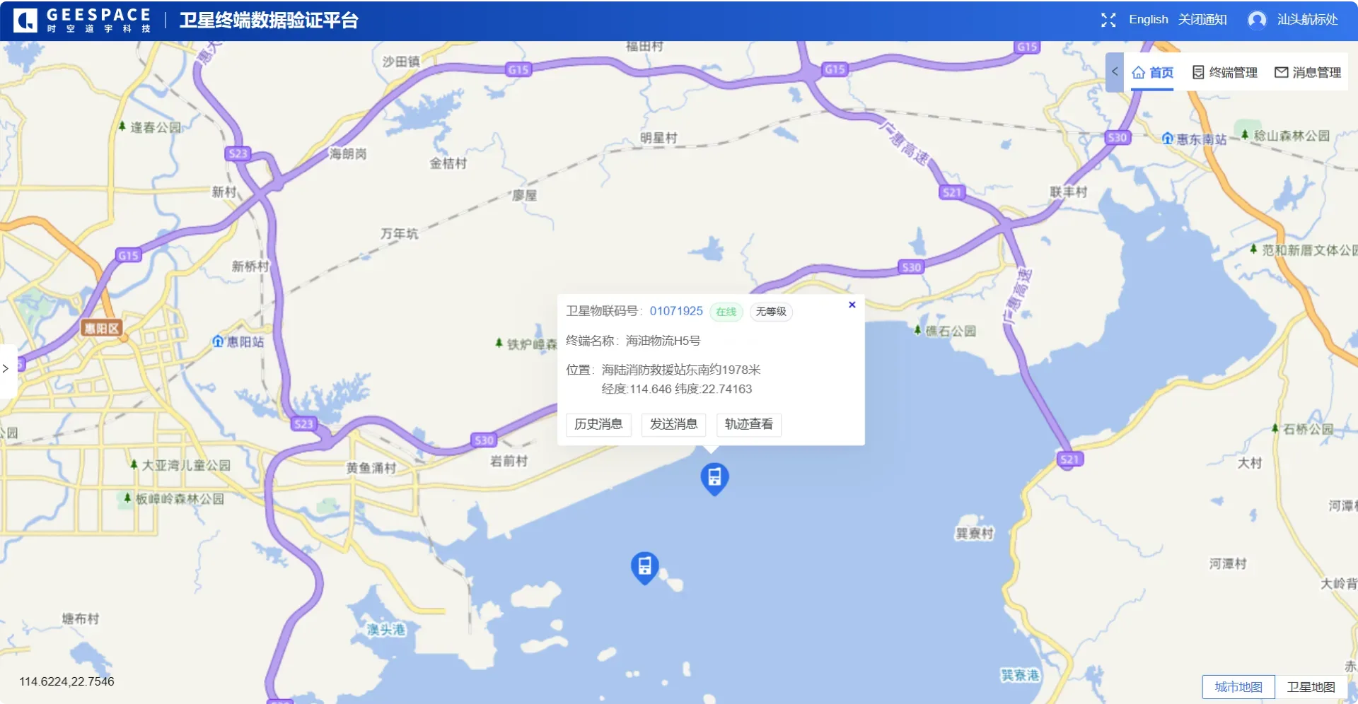
From June to August, the 4G and satellite dual-link backup mechanism operated effectively during the pilot period. The LEO satellite communication terminals maintained stable signals and controllable latency, enabling continuous, real-time transmission of all relevant data, including navigation buoy positions and equipment operating status. The communication success rate improved significantly compared with traditional communication links. Nearly 5,000 data transmission tests were completed, achieving an overall transmission success rate of 99.67%.
Going forward, Geespace’s LEO satellite IoT communication technology will be further integrated with navigation buoy lighting equipment, enabling operational data to be transmitted to the management platform. This data will include positioning information, light battery levels, voltage, ambient temperature and humidity, and other equipment operating parameters. This will provide essential data support for remote monitoring, operational management, and intelligent maintenance of maritime aids to navigation.
